Our Cruise Lady Holy Land tour is over, but we're still here. In fact, several of our group have stayed an extra day or two, and we saw at least 8 at breakfast in the Olive Tree Hotel. One couple, the Farrells, joined us for our first activity of this "extra" day, going to the City of David Archaeological Park, including Hekekiah's Tunnel. After that it was just me, Rachel, my sister, Lori, and her husband, Royd.


The Jebusite city of Shulam, or Salem, lay on the lowest of Jerusalem's three main hills. But because it had a perennial source of water, the Gihon Spring, it was the first one settled. Mount Moriah, or the Temple Mount, lies just north of it, and the Western Hill lay across the Tyropoean Valley. This valley joins with the eastern vale, the Qidron Valley, at the south end of the hill. David conquered this city and made it his capital. Under both David and his son Solomon, it was the capital of a united kingdom of Israel.
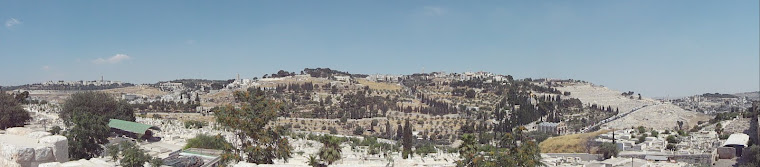
After watching a 3D movies illustrating the history of the City of David and the greater Jerusalem it became a part of, we went up on to the outlook area above the park for good pictures of almost every vantage point.
After walking through the Bronze and Early Iron Age remains, we entered Hezekiah's Tunnel, which fed water into the ancient Pool of Siloam within Jerusalem's walls.


The tunnel currently disembogues its water into a Byzantine-era pool. The original, first century pool, which seems to have served the double purpose of a water storage catchment and a ritual purification pool, is currently being excavated. It is the scene of the important miracle of healing the man born blind recounted in John 8.


We then climbed the stairs of the old processional way that led from the Pool of Siloam up the Tyropoean Valley to the Temple Mount. The valley is largely filled in now, so the steps have needed to be excavated and now lie in a tunnel, some of which also passes through the drainage tunnel that lay beneath the original steps.


We took our leave of the Farrells after that and took a taxi to West Jerusalem, where we visited the Anglican International School of Jerusalem, where Rachel had attended tenth grade when we lived here in 2011-2012. It provided her a nice sense of closure, and we were able to meet people we had known and liked such as her friend Annie, some other students and teachers, and my friend Dr. Reverend Lawrence Hilditch, the director of the school.


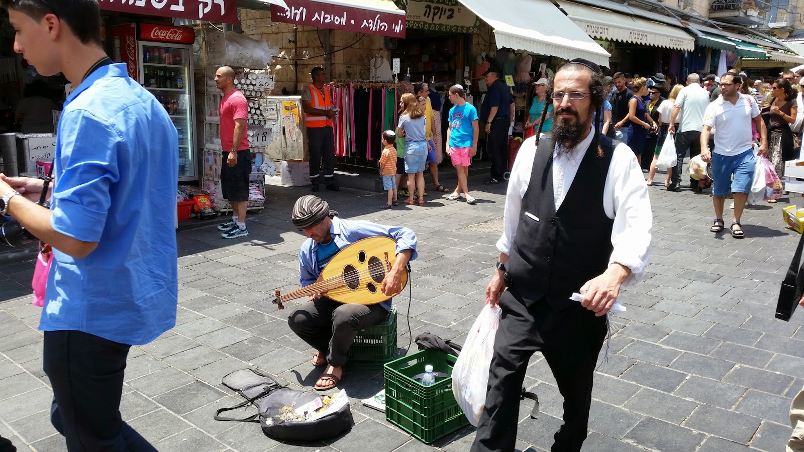
Our next activities were to walk through the suq or covered marketplace known as Mahane Yehuda. We then walked down the Ben Yehuda Street pedestrian mall and had lunch.


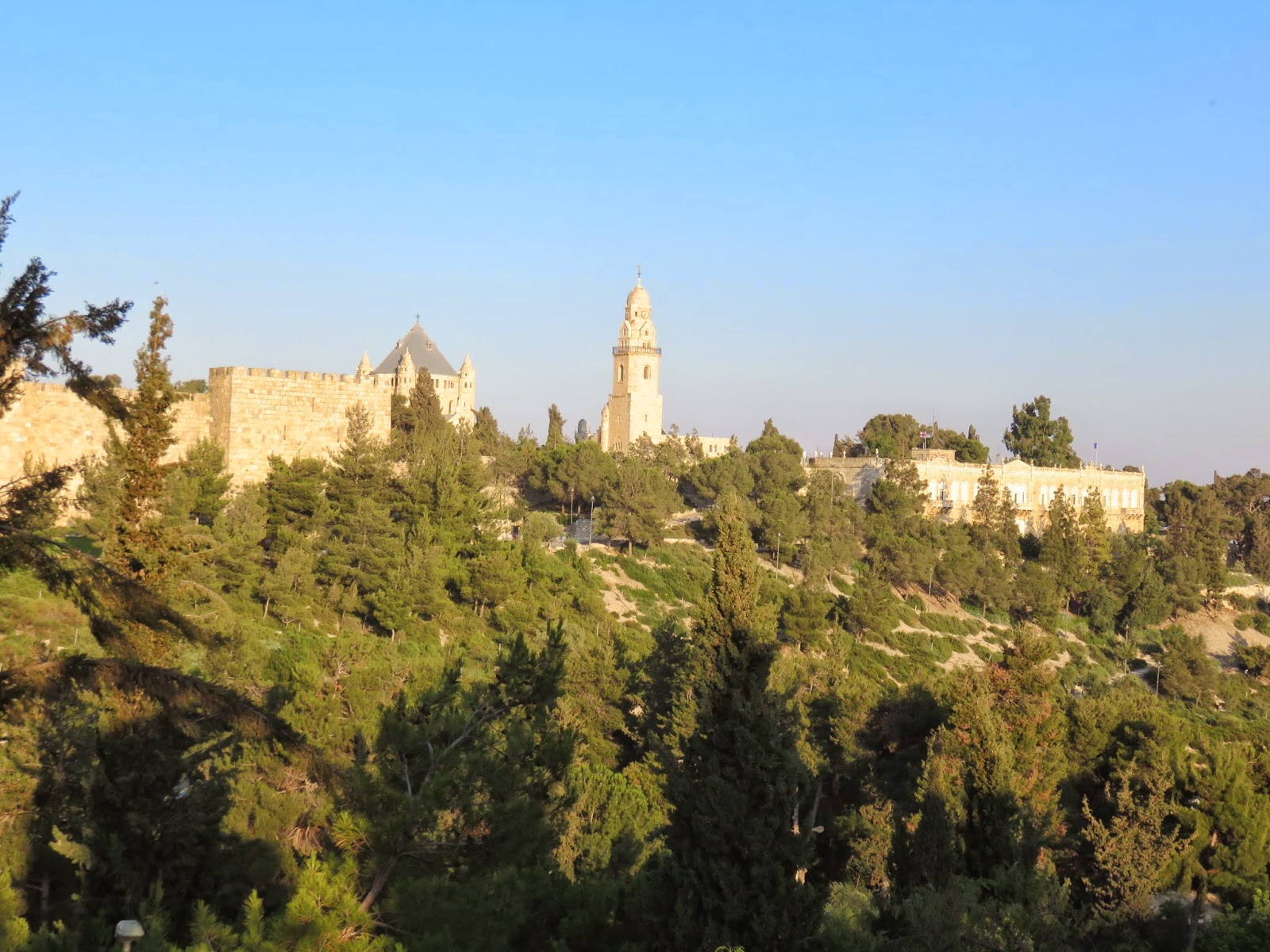
After changing from the Olive Tree to the Christ Church Guest House right inside Jaffa Gate (pictures hopefully tomorrow), I took my family on a walk out the gate and across to Mamilla. We then climbed through the park west of the Old City to explore the elite first century tomb widely assumed to have been the Herodian Family sepulchre (Herod himself was buried at the Herodion southeast of Bethlehem).
The tomb is on a hill that looks across to the walls of what is now in the Armenian Quarter. In Jesus' time, it would have been across from Herod's Palace, built on the highest point of Jerusalem.


Dinner was next. No one does steak in the Old City like the Armenians. Steak was just what was needed after two weeks of falafel, shwarma, and kebobs.


After that, we went to the Western Wall. Shabbat had started at sundown, and the crowds worshiping on the Sabbath due so with more gusto and joy. No pictures because cameras and picture-taking are forbidden there on the Sabbath.
The Jebusite city of Shulam, or Salem, lay on the lowest of Jerusalem's three main hills. But because it had a perennial source of water, the Gihon Spring, it was the first one settled. Mount Moriah, or the Temple Mount, lies just north of it, and the Western Hill lay across the Tyropoean Valley. This valley joins with the eastern vale, the Qidron Valley, at the south end of the hill. David conquered this city and made it his capital. Under both David and his son Solomon, it was the capital of a united kingdom of Israel.
After watching a 3D movies illustrating the history of the City of David and the greater Jerusalem it became a part of, we went up on to the outlook area above the park for good pictures of almost every vantage point.
 |
| Looking due north to the Temple Mount |
 |
| Looking east to the Mount of Olives |
 |
| Looking southwest down the lower Qidron Valley |
 |
| Looking east towards Mt. Zion |
 |
| Looking northwest towards the Western Hill, now the Jewish Quarter |
The tunnel currently disembogues its water into a Byzantine-era pool. The original, first century pool, which seems to have served the double purpose of a water storage catchment and a ritual purification pool, is currently being excavated. It is the scene of the important miracle of healing the man born blind recounted in John 8.
We then climbed the stairs of the old processional way that led from the Pool of Siloam up the Tyropoean Valley to the Temple Mount. The valley is largely filled in now, so the steps have needed to be excavated and now lie in a tunnel, some of which also passes through the drainage tunnel that lay beneath the original steps.
We took our leave of the Farrells after that and took a taxi to West Jerusalem, where we visited the Anglican International School of Jerusalem, where Rachel had attended tenth grade when we lived here in 2011-2012. It provided her a nice sense of closure, and we were able to meet people we had known and liked such as her friend Annie, some other students and teachers, and my friend Dr. Reverend Lawrence Hilditch, the director of the school.
Our next activities were to walk through the suq or covered marketplace known as Mahane Yehuda. We then walked down the Ben Yehuda Street pedestrian mall and had lunch.
After changing from the Olive Tree to the Christ Church Guest House right inside Jaffa Gate (pictures hopefully tomorrow), I took my family on a walk out the gate and across to Mamilla. We then climbed through the park west of the Old City to explore the elite first century tomb widely assumed to have been the Herodian Family sepulchre (Herod himself was buried at the Herodion southeast of Bethlehem).
The tomb is on a hill that looks across to the walls of what is now in the Armenian Quarter. In Jesus' time, it would have been across from Herod's Palace, built on the highest point of Jerusalem.
Dinner was next. No one does steak in the Old City like the Armenians. Steak was just what was needed after two weeks of falafel, shwarma, and kebobs.
After that, we went to the Western Wall. Shabbat had started at sundown, and the crowds worshiping on the Sabbath due so with more gusto and joy. No pictures because cameras and picture-taking are forbidden there on the Sabbath.
No comments:
Post a Comment